Visual Materials
Map of the State of Louisiana with parts of the State of Mississippi & Territory of Alabama from Actual Surveys by Wm. Darby. Entered according to Act of Congress April 8 1816 by Wm. Darby
You might also be interested in
Image not available
State of Mississippi and Alabama Territory
Visual Materials
Kashnor notes, "An early map of the State soon after its incorporation." Kashnor dates as ca. 1810. Prime meridian: London, Philadelphia. Relief: hachures. Graphic Scale: Miles. Projection: Cylindrical. Printing Process: Copper engraving. Verso Text: MS note: 448.
093:448 S
Image not available
Carte de la Virginie et du Maryland Dresée sur le grande carte Anglois de Mrs. Josué Fry et Pierre Jefferson, Par le Sr. Robert de Vaugondy Géographe ordinaire du Roi. Avec Privilege 1755
Visual Materials
Kashnor notes, " Also takes in the Delaware counties and part of New Jersey." "Grave E. Haullard" Prime meridian: Ferro. Relief: pictorial. Graphic Scale: Leagues. Projection: Cylindrical. Watermark: Shiled lettering. Printing Process: Copper engraving. Verso Text: Stamp: 105 MS note: 105-513.
105:513 M

Carte des Antilles Francoises et des Isles Voisines Dresée sur les memoires manuscrits De Mr. Petit Ingenieur du Roy, et sur quelques observations. Par Guilleaume de L'isle et de l'Academie Rle. des Sciences et Premier Geographe du Roy
Visual Materials
Short history of these islands lower right. Kashnor dates as ca. 1720. See 105:945M and 093:721M for earlier versions. Prime meridian: Ferro. Relief: no. Graphic Scale: Leagues. Projection: Cylindrical. Printing Process: Copper engraving. Verso Text: MS notyes: 105/471 146 Les Isles Antilles 76.
105:471 M

United States of North America, with the British & Spanish Territories according to the Treaty
Visual Materials
Kashnor notes, "Similar to Faden's map of "The British Colonies in North America," with the addition of colored contours indicative of the British, Spanish, French and American frontiers." See 093:544, 093:545 for later copies. Cartouche of Caribbean traders.. Prime meridian: London. Relief: pictorial. Projection: Pseudocylindrical. Watermark: Crowned fluer-di-lis VI. Printing Process: Copper engraving. Other Features: Cartouche. Verso Text: MS notes : 105 148.
105:148 M

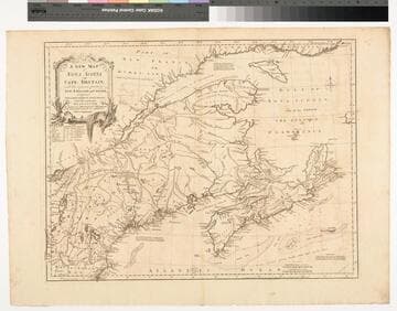
A New Map of Nova Scotia and Cape Britain. with the adjacent parts of New England and Canada, Composed from a great number of actual Surveys ; and other materials Regulated by many new Astronomical Observations of the Longitude as well as Latitude ; with an Explanation
Visual Materials
Kashnor notes, "The first issue of Jefferys' map. It was re-issued twenty years later by Sayer and Bennett." Kershaw states this is the second state of Jefferys map. Prime meridian: London, Ferro. Relief: pictorial. Graphic Scale: Miles, leagues. Projection: Pseudocylindrical. Watermark: I Ville Ary under IHS Crowned fleur-di-lis over LVC. Printing Process: Copper engraving. Other Features: Cartouche. References: Kershaw 739; McCorkle 755.20. Verso Text: MS note: 668.
105:668 M
Image not available
United States of North America, with the British Territories
Visual Materials
Kashnor notes, "A good Western map tracing the course of the Missouri to the Yellowstone. Wisconsin is still North-West Territory, and over the border in the present Manitoba Province are the locations of the N. W. Company forts." See 093:603M, 105:656M for an earlier copy, 105:605M for a later copy. Prime meridian: London. Relief: pictorial. Graphic Scale: Miles, leagues. Projection: Pseudocylindrical. Printing Process: Copper engraving. Verso Text: MS note: 604.
093:604 M