Opening Hours
Daily: 10 A.M.–5 P.M.
Closed on Tuesdays
1151 Oxford Road
San Marino, CA 91108
Visual Materials

Daily: 10 A.M.–5 P.M.
Closed on Tuesdays
1151 Oxford Road
San Marino, CA 91108

Image not available
Visual Materials
Seal: Depot General de la Marine - lower right. Prime meridian: Paris. Relief: hachures. Projection: Mercator. Printing Process: Copper engraving. Verso Text: MS note: 687.
093:687 M
Visual Materials
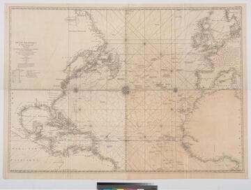
Kashnor notes, "a scarce map [after Jefferys] issued for the use of the French allies during the Revolution." One map in two sheets. Navigational notes, compass variations, various voyages. Author and appeared in references from RLIN record [this record for upper section] Three compass roses. . Prime meridian: London, Ferro. Relief: no. Graphic Scale: Leagues, Marine. Projection: Mercator. Watermark: Chained Maltese Cross Dupys Moyen(?). Printing Process: Copper engraving. Verso Text: MS notes : 34 (upper) 56 (lower) 63.
105:063 M
Visual Materials
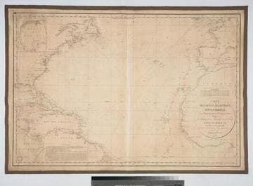
Kashnor notes: "Takes in the American coast from Newfoundland to Para." MS note: 709 (upper left) Two voyage tracks on right side (one indicating 50 days to or from San Francisco). Submaps: Golfe du Mexique.. Prime meridian: Paris. Relief: no. Projection: Mercator. Printing Process: Copper engraving. Other Features: Sub-mapsCartouche.
093:709 M
Visual Materials
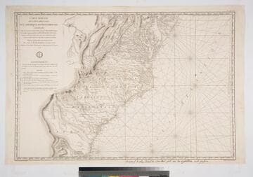
Kashnor notes, "This is one of the charts issued for the use of French naval officers during the American Revolution." Seal of Depot de la Marine. MS note: bottom below neatline giving place of sale. . Prime meridian: Paris. Relief: hachures. Graphic Scale: Leagues. Projection: Mercator. Printing Process: Copper engraving. Verso Text: MS note: 318 M4.
105:318 M
Visual Materials
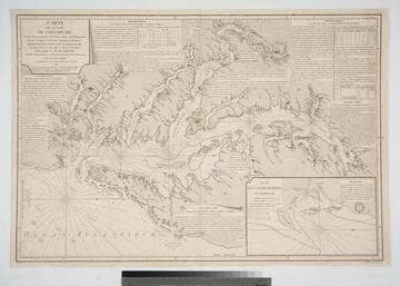
Kashnor notes, "One of the French charts issued for the use of transports and ships-of-war operating with the American colonists." Shows sailing directions. See 105:086M for an earlier larger version of this map. Appeared in information from The American Revolution 1775-1783, Naval History Division, Dept of the Navy, Washington, 1972. Huntington Reference f G1201 S3 U5. Submap: Plan de la Baie Herring en Maryland. Seal of Depot de la Marine.. Prime meridian: Paris. Relief: no. Projection: Mercator. Printing Process: Copper engraving. Other Features: Sub-maps.
105:149 M
Image not available
Visual Materials
Kashnor notes, "Shows the country West of Lake Bourbon, and locates a number of the old French forts." Kashnor dates as ca. 1760. May be as late as 1780, per reference in Rosenthal which also provides appeared in information. "Liv. XV, XVI et XVII. (upper left). No. 45 (upper right) André sculp." Ms. note: 502 (on backing). Prime meridian: Paris, Ferro. Relief: pictorial. Graphic Scale: Miles, leagues. Projection: Pseudocylindrical. Printing Process: Copper engraving. Verso Text: MS note: 502.
105:502 S