Opening Hours
Daily: 10 A.M.–5 P.M.
Closed on Tuesdays
1151 Oxford Road
San Marino, CA 91108
Visual Materials
Daily: 10 A.M.–5 P.M.
Closed on Tuesdays
1151 Oxford Road
San Marino, CA 91108
Image not available
Visual Materials
Kashnor notes, "Includes the Bahamas and a portion of Cuba." MS note in French, lower right. Submap of Mississippi delta. Cartouche: draped. Submap: Carte des Embouchures du Fleuve St. Louis. Seal of Depot de la Marine. MS notes: lower right (in French). Prime meridian: Paris. Relief: no. Graphic Scale: Leagues. Projection: Cylindrical. Watermark: Shield lettering. Printing Process: Copper engraving. Other Features: CartoucheSub-maps. Verso Text: MS note: 480 M2.
105:480 M

Visual Materials
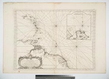
Inset map of Cayenne Harbor, French Guiana. Cartouche: shell and flowers. Submap: Carte de l'Entrée de Cayenne.. Prime meridian: Paris. Relief: pictorial. Graphic Scale: Leagues. Projection: Mercator. Watermark: Leaf-heart device lettering. Printing Process: Copper engraving. Other Features: CartoucheSub-maps. Verso Text: MS note: 472 .
105:472 M

Visual Materials
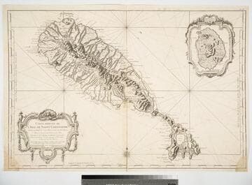
Cartouche: flowered with urns. Submap: Isle du Nieves.. Prime meridian: Paris. Relief: pictorial. Graphic Scale: Leagues. Projection: Cylindrical. Watermark: Device lettering. Printing Process: Copper engraving. Other Features: Sub-maps. Verso Text: MS note: 825.
093:825 M
Image not available
Visual Materials
Cartouche: Crowned floral. Vignettes: Vue des Terres entre le Cap d'Orange et Cayenne; Vue de la Coste aux Environs de Cayenne.. Prime meridian: Teneriffe, Ferro, Paris. Relief: pictorial. Graphic Scale: Leagues. Projection: Cylindrical. Watermark: Crowned two headed bird lettering. Printing Process: Copper engraving. Other Features: CartoucheVignettes. Verso Text: MS note: 657 Cotes de la Gayana..
093:658 M
![Carte Réduite de l'Isla de Cube Dréssée au Dépot des Cartes et Plans de la Marine Pour le Service des Vaisseaux du Roy Par ordre de Mle. Duc de Choiseul Colonel général des Suisses et Grisons, Ministre de la Guerre et de la Marine. Par le S. Bellin Inginieur de la Marine et du Dépost des Plans, Censeur Roal de l'Acadamie de Marine et de la Societé Royale de Londres. M.DCC.LXII. [1762]](/_next/image?url=https%3A%2F%2Frail.huntington.org%2FIIIF3%2FImage%2F22APN4KO0IT2%2Ffull%2F%5E360%2C%2F0%2Fdefault.jpg&w=750&q=75)
Visual Materials
Cartouche: reptiles.. Prime meridian: Parid. Relief: pictorial. Graphic Scale: Leagues. Projection: Cylindrical. Watermark: Lettering crowned birds. Printing Process: Copper engraving. Other Features: Cartouche. Verso Text: MS note: 373.
105:373 M

Visual Materials
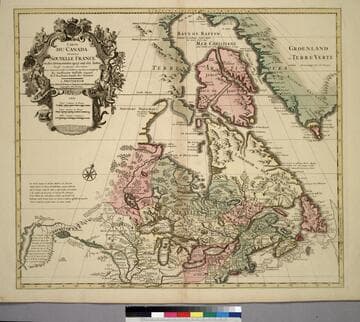
Kashnor notes, "The map still shows the territory around the southern part of Hudson's Bay as French territory, with Fort Nelson called Fort Bourbon, and Fort St. Louis on Moose River. The supposed Western Sea is taken from particulars furnished by La Houton." See 105:433 for earlier version, 105:432 for later. McCorkle identifes this as 1708 version. Cartouche with natives. Photocopy stored with map.. Prime meridian: Ferro?. Relief: pictorial. Graphic Scale: Miles, leagues. Projection: Pseudocylindrical. Watermark: C (symbol) I H (lettering). Printing Process: Copper engraving. Other Features: Cartouche. References: McCorkle 703.5. Verso Text: MS notes: Canada et Nouvelle France 105/431 Canada, ou la Nouvelle France. 3.
105:431 M