Opening Hours
Daily: 10 A.M.–5 P.M.
Closed on Tuesdays
1151 Oxford Road
San Marino, CA 91108
Visual Materials
Daily: 10 A.M.–5 P.M.
Closed on Tuesdays
1151 Oxford Road
San Marino, CA 91108

Image not available
Visual Materials
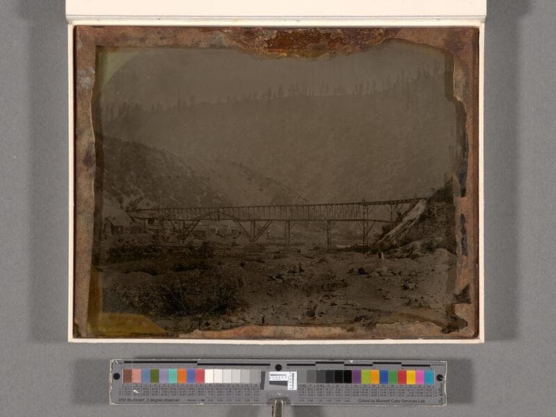
View of a long flume across a rocky canyon at a mining site. Men can be seen standing on flume. Probable location determined by Library staff late-20th century based on similarity to sketch of Smith's Bar by Lamson at California Historical Society. See collection file for correspondence and copy of sketch. Date based on years of major usage of ambrotypes.
(photDAG 26)
Visual Materials
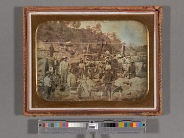
View of about 30 men, including some Native Americans, with tools, working along a rocky riverbank. A diversion flume structure visible behind miners.
photDAG 55
Image not available
Visual Materials
View of about 30 men, including some Native Americans, with tools, working along a rocky riverbank. A diversion flume structure visible behind miners. Handwritten note accompanying photograph reads: "Gold mine of Walter Taylor, Taylorsville, Calif. 1849. Uncle Walter died here in 1850," though this information has been disputed, since Taylorsville in Plumas County was not active at this time. Possibly this is another location named Taylorsville or misinformation. See collection file for correspondence disputing location.
(photDAG 55)
Image not available
Visual Materials
View of flume, showing details, with tents in background in a canyon. Handwriting inside case, under plate, reads: "Louisiana Company's Flume on the Mokelumne River. Taken Oct. 1853. View of upper part of [__?] and all of the [Ramsbottom?] and a part of the [Minters? Bank?]." A list of names follows: "Capt. Birdsall, Boston; Capt. Bunker, Lowell; Demithy Reid, S.C.; Horatio Reynolds; H. E. Chesebrough & [Mathew?] Lightman; Luke Chesebrough; G. Shannon; Tom Thompson; Lorna; Shorb [C?] & Bell." In addition, another note inside the case reads: "Chesebrough's Flume, Maquilumne [sic] River, Calaveras Co. Cal. 1852, 1853 & 1854."
(photDAG 54)
Visual Materials
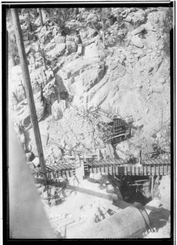
Big Creek, Mono-Bear Diversion - Looking north across Mono Creek at site of Mono Dam. Men can be seen working in the trench and the section of forms in the center of the picture has already been filled with the first concrete poured in the construction of this dam. The flume extending across the picture is for diverting Mono Creek through the dam while construction is underway. One of the sections at the intake end of the Mono flowline is showing in the bottom of the picture.
photCL SCE 02 - 14719
Visual Materials
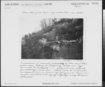
Big Creek Powerhouse #4 - Photo taken at site before any construction was started. Narrowness of channel indicated by this view taken across river, looking at temporary hoist and high line used to transport men, equipment, and materials for footbridge across river. Cables will be anchored in exposed face in lower left foreground. Tower can be seen assembled and lying on bridge ready to lower into place.
photCL SCE 02 - 42586