Manuscripts
Map showing the Indian boarder line running from Fort Clark, or Osage, south to the Arkansas River
Image not available
You might also be interested in
Image not available
Map of the original plot of the survey from Fort Osage to Santa Fe :
Manuscripts
Map dated 1827.
mssHM 84397
Image not available
Map showing the Los Angeles River H. Hancock and G. Hansen lines
Manuscripts
mssHM 84438
Image not available
Map showing the boundaries of early New Jersey Patents (1681-1776) for lands lying between the South and Raritan Rivers in Middlesex County
Manuscripts
mssHM 530
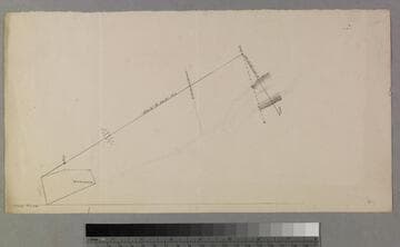
Draft of a map showing a line running South 31 1/2 degrees East from the northeast corner of an orchard : possibly Temple Block and Street
Manuscripts
Located in the folder for Temple Block and Street, but nothing on the map itself to identify it. Look at entire folder for context.. Title supplied by cataloger.
mssSolano SR_Box_32(30).01