Opening Hours
Daily: 10 A.M.–5 P.M.
Closed on Tuesdays
1151 Oxford Road
San Marino, CA 91108
Manuscripts
Image not available
Daily: 10 A.M.–5 P.M.
Closed on Tuesdays
1151 Oxford Road
San Marino, CA 91108

Image not available
Manuscripts
Map of proposed irrigation system on Azusa Ranch lands includes Rancho La Puente (Phillips tract), and Wash of the San Gabriel River surveyed by V.J.Rowan.
mssAzusa
Image not available
Manuscripts
The map surveyed by Ernest Robertson includes Azusa Rancho, La Puente Rancho, and San José addition. Blueprint.
mssAzusa
Manuscripts
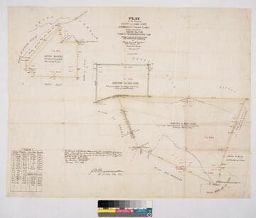
Bordered by public lands, Rancho Los Nogales, Rancho Santa Ana del Chino, Rancho La Puente, Rancho of A. Duarte, Azusa Mountains. Addition is to Rancho San José. Colored borders. Hachures indicating hills. Variation 13° 30' East. Containing 27151 327/1000 acres. Surveyed under the Instructions from the U.S. Surveyor General - J.W. Mandeville signature. Inset of Field Notes table with coordinates and distances
mssSolano SR_Map_0008
Visual Materials
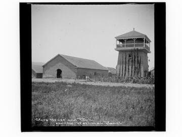
View of a large barn and water tank on the ranch of William Workman (1799–1876) in Rancho La Puente (present day City of Industry, California).
photCL_555_06_208
Image not available
Manuscripts
This is an invoice made out by William Workman for Dr. Gelcich's visit to Rancho La Puente. It includes fees for the doctor's visit, a consultation with Workman's son-in-law Francis Pliny F. Temple, and medication.
mssHM 68330
Manuscripts
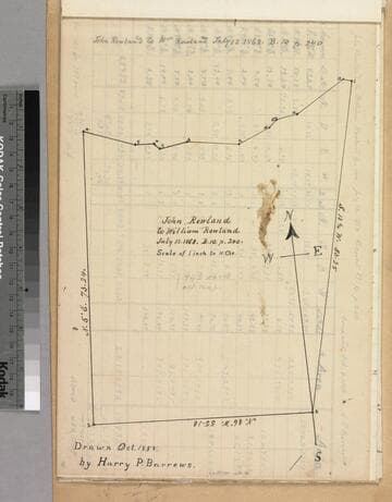
This and the rest of the maps are bound in folder: "Goodwin et al vs. Rowland, Survey of Rancho la Puente..." p. 4; with courses, distances. Title supplied by cataloger.
mssSolano SR_Box_22(13).03