Manuscripts
Map of Central America from J. Arrowsmith's Map of the West Indies
Image not available
Manuscripts
Image not available
Daily: 10 A.M.–5 P.M.
Closed on Tuesdays
1151 Oxford Road
San Marino, CA 91108

Image not available
Rare Books
"Compiled and Drawn in the Cartographic Section of The National Geographic Society for the National Geographic Magazine Gilbert Grosvenor, Editor. Washington, 1939. Arthur H. Bumstead, Chief Geographer." Submaps: Puerto Rico and the Virgin Islands; Saint Thomas; Isthmus of Panama; Jamaica: Cuba: Bermuda Islands. Prime meridian: GM. Relief: hachures. Graphic Scale: Miles, kilometers. Projection: Polyconic. Printing Process: Lithography.
239992
Image not available
Visual Materials
Kashnor notes, "Privately printed for the Hudson's Bay Company and its officers. Indicates, by colour, the respective possessions of the Company and those of the British and Russian crowns; also the Company's stations outside of their chartered territory, and those of the Church Missionary Society." Map shows isothermal lines, relative area of Hudson's Bay Company's Chartered Territory (Ruperts Land) as 1,427,930 square miles, vs. France (207,252 sq. mi.) England and Wales (57,812 sq. mi.) and Russia (2,120,397 sq. mi.). Some thirty three properties outside the chartered territory are shown, some in the US. Prime meridian: GM. Relief: hachures. Graphic Scale: Miles. Projection: Conic. Printing Process: Lithography. Verso Text: MS note: 442.
105:442 M
Image not available
Manuscripts
mssHM 2291
Image not available
Visual Materials
One sheet with maps of six islands. Kashnor dates as ca. 1719. Submaps: Generall Chart of the West Indies; Barbados with St. Michaels or the Bridge Town; Bermudos; Tobago; Antego; St. Christophers; New Map of the Island of Jamaica; The Harour of Port Royall.. Relief: pictorial. Graphic Scale: Miles (each map). Projection: Plane. Watermark: Fleur-de-lis BA. Printing Process: Copper engraving. Other Features: Submaps.
093:727 M
Visual Materials
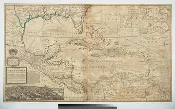
Kashnor notes, "The map also shows parts of Louisiana and South Carolina, and Central America. It is dedicated to William Paterson, the promoter of the Darien Colony." Kashnor dates as ca. 1720. View of Mexico City. Five submaps. See also 105:328M for another copy. View of Mexico City with building key; Submaps: St. Augustine; Vera Cruz; Havana; Darien; Cartagena.. "with the adjacent Countries; explaning [sic] what belongs to Spain, England, France, Holland &c. also the Trade Winds, and the several Tracts [sic] made by the Galeons [sic] and Flota from place to place. According to the Newest and most Exact Observations by Herman Moll Geographer." "To Wil. Paterson Esq; This map of the West-Indies &c. is most Humbly Dedicated by Herman Moll Geographer." Prime meridian: London. Relief: pictorial. Graphic Scale: Miles, leagues. Projection: Pseudocylindrical. Printing Process: Copper engraving. Other Features: VignettesSub-maps. Verso Text: MS notes: 958.
105:958 M