Opening Hours
Daily: 10 A.M.–5 P.M.
Closed on Tuesdays
1151 Oxford Road
San Marino, CA 91108
Rare Books
Image not available
Daily: 10 A.M.–5 P.M.
Closed on Tuesdays
1151 Oxford Road
San Marino, CA 91108
Image not available
Rare Books
336835
Image not available
Rare Books
446357

Rare Books
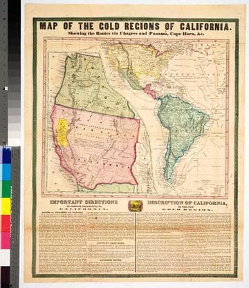
No marks as to maker or publisher, below the map are "Important Instructions" to person planning to use the various routes and another section "Description of California." Because a number of rivers are fairly accurately described the date would appear to be late 1849 or 1850. The map is described and the publisher identified in Carl I. Wheat's Mapping the Transmississippi West, volume 3, page 78, map 609. The map is divided in two sections, one showing an expanded California and Oregon with the Gold Region in yellow; the second showing routes from New York to California and including all of South America. Descriptive tables below map. MS note: 43465. Prime meridian: Washington DC. Relief: hachures. Projection: Pseudocylindrical. Printing Process: Lithography.
43465