Opening Hours
Daily: 10 A.M.–5 P.M.
Closed on Tuesdays
1151 Oxford Road
San Marino, CA 91108
Rare Books
Image not available
Daily: 10 A.M.–5 P.M.
Closed on Tuesdays
1151 Oxford Road
San Marino, CA 91108

Image not available
Manuscripts
Manuscript by Ambroise Tranquille Sassard, in French, on the treatment of pain in medicine that was published later in the October 1780 issue of Le Journal de Physique de l'Abbe Rozier. There is a handwritten note by Sassard that translates to "I was 28 years old when I wrote and published this dissertation."
mssHM 84010
Image not available
Rare Books
Marey's work on graphical recording, "used to depict physiological variables, such as the sphygmograph, cardiograph and myograph."--Rothschuh, History of physiology, p. 274.
658293
Rare Books
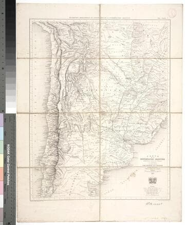
Kirkpatrick Catalogue entry: "2472 l Moussy, V. M. de. Carte de la Confédération Argentine ... et de pays voisins, État oriental de l'Uruguay, Paraquay, partie du Brésil et da la Bolivie. Paris, Imp. Lemercier, 1867. 1 sheet. [see p.]." MS notes at bottom of sheet, the one on the right reads "Sr. Presidente Mitre." Probably obtained while Burton was in South America between 1865 and 1868. MS notes: bottom margin names. RB 11492 t Stamp: Kensington Pu8blic Libraries.. Prime meridian: Paris. Relief: hachures. Graphic Scale: Milesm leagues. Projection: Polyconic. Printing Process: Lithography. Verso Text: MS notes: Argentine Confederation 2472 p maps Moussy. Sticker R.B. 11492 t..
623646
Rare Books
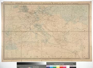
Kirkpatrick Catalogue entry: "2503 [Andriveau-Goujon] Navigation à vapeur dans le bassin del la Méditerranée et chemins de fer de l'Europe centrale. Paris, E. Andriveau-Goujou [sic]; London, Edward Stanford, 1868. 1 sheet. [see p.]."Sea routes traced in different colors indicating the nationality and type of ship operating. Verso has Stanford paste on labels. Clearly a French map, Stanford selling in the British market. Prime meridian: Paris. Relief: no. Graphic Scale: Miles, leagues. Projection: Polyconic. Printing Process: Lithography. Verso Text: Stamps: Kemsington Public Libraries. Standford labels..
623677
Rare Books
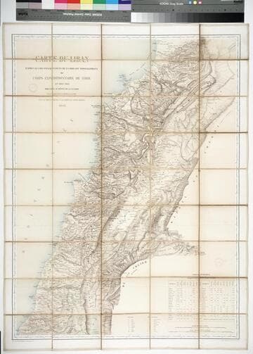
Kirkpatrick Catalogue entry: "2483 Blondel, L. A. Carte du Liban d'après les reconnaissances de la Brigade topographique du Corps expéditionnaire de Syrie en 1860-1861, dressée au Dépôt de la Guerre ... Paris, Imp. Lemercier, 1862. 1 sheet. [see p.]."Statistical table in the bottom right gives population of the major towns and cities in Lebanon by religion. Case which previously held the map gives alternate title, and the bookseller in Beirut who sold the map. Label on case reads "Charlier-Béziès Beyrouth Librairie Commission Articles divers." Population table. Stamp: Kensington Public Libraries. Prime meridian: Paris. Relief: hachures. Graphic Scale: Kilometers, leagues. Projection: Cylindrical. Printing Process: Lithography. Verso Text: Stamps: Kensington Public Libraries.
623657
Image not available
Visual Materials
Latitude and Longitude lines for Quebec marked. See 093:352 for an English version of this map which attributes the data to D'Anville. Kashnor dates this map at ca. 1760. See 105:682M for another copy. Kershaw dates as 1755. Relief: no. Graphic Scale: Leagues. Projection: Cylindrical. Watermark: Device - lettering. Printing Process: Copper engraving. References: Kershaw 625. Verso Text: MS note: 357.
093:357 M