Rare Books
A collection of accurate hydrographic plans, on a large scale, of the principal ports, bays, roads, and harbours, in the West-Indies : namely those of the Spanish main and Florida, of the islands of Jamaica, Hayti or St. Domingo, Cuba, and Porto Rico: wherein are minutely represented, the anchoring and watering places, soundings, rocks, shoals, &c. accompanied with a general chart of the West-Indies
Image not available
You might also be interested in
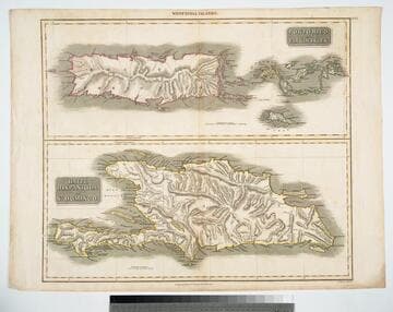
Haiti, Hispaniola or St. Domingo; Porto Rico and Virgin Islands
Visual Materials
Two maps on one sheet. Kashnor dates as [1814]. Prime meridian: GM. Relief: hachures. Graphic Scale: Miles. Projection: Cylindrical. Printing Process: Copper engraving. Verso Text: MS note: 423.
105:423 M
Image not available
British West Indies: Jamaica (4 images and a 1932 letter)
Manuscripts
This collection contains the papers of English art historian Katharine Ada Esdaile (1881-1950), with the bulk of the materials relating to her research and writings on British monumental sculpture, sculptors, and church monuments from the medieval period to 19th century. Material types include personal writings, diaries, correspondence, business papers, family papers and photographs, research files and research notebooks, and miscellaneous published and unpublished materials. Notably the collection includes more than 600 chiefly pre-World War II visitor booklets and pamphlets produced locally by British churches and approximately 3500 photographs taken or collected by Esdaile of sculpture, often funerary monuments in English churches, ranging from large churches like Westminster Abbey to small rural parishes. This collection provides a resource for viewpoints on monumental sculpture in the early 20th century (for instance as represented in book reviews by Esdaile) and for information about Esdaile's experience as a woman art historian in the early 20th century. Given the broadness of Esdaile's scope, from medieval to 19th century British monumental sculpture, the collection is less useful for specific information about monuments or sculptors. In addition, many of Esdaile's attributions in her notes appear to have been based primarily on her own instincts and do not have citations. Many of Esdaile's notes are handwritten on small scraps of paper or are fragments, sometimes making the information difficult to parse. The collection is chiefly Esdaile's files, but the dates on some items (such as post-1950 booklets) indicate the collection was added to and used after her death, presumably by her son Edmund Esdaile, who also made notes on items in the collection and appears to have done the preliminary organization of the papers after Esdaile's death.
mssEsdaile
Image not available
Beeston, Sir William. To James Vernon. Jamaica, [West Indies]
Manuscripts
Enclosure : 1699, Apr. 20 Forbes, Charles and 4 others. To William Beeston.
HM 32283
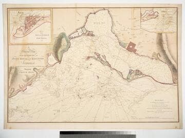
General Plan of the Harbours, of Port Royal and Kingston Jamaica with the Channels leading thereto and the Kays and Shoals adjacent Including Wreck Reef
Visual Materials
Two insert maps. Submap: Plan of the Town and Harbour of Port Royal 1772.; Plan of Fort August and the Narrow Channel.. Relief: hachures. Graphic Scale: Miles. Projection: Plane. Printing Process: Copper engraving. Other Features: Sub-maps. Verso Text: MS note: 793.
093:793 M
Image not available
United States coast pilot : West Indies, Puerto Rico and Virgin Islands
Rare Books
488752
Image not available
By the King. A proclamation for the encouraging of planters in His Majesties island of Jamaica in the West-Indies
Rare Books
283821